Are you interested in it? Read more - English texts are blue.
Interessieren Sie sich dafür? Deutsches Info in Rot.
Domina? Skaitykim toliau: liet. tekstai - juodomis raidėmis.
 |
KNOWTH: Akmens amžiaus pilkapiai * Stone Age Monuments
MIDSUMMER: THE GREEN HISTORY
I know an
Irish woman who lives in Lithuania and uses to say: "I am of Celtic
origin!" Who are the Irish people of Celtic origin and why do they learn
Irish in the school but usually speak English? With the questions you
are tempted to explore the complicated Irish history. "The only way to get
rid of temptation is to yield to it" (O. Wilde, the famous English-Irish
writer). Celts is the best way, to begin with.
The Irish
language is a member of the Celtic language family that was spoken across much of Continental Europe (Germany, France etc.). It
isn't clear when Celtic tribes reached Ireland. But in the Christian
era it definitely was a Celtic country. Christianity were
introduced to Ireland in the 5th century. In Irish life the monasteries
played a major role. The rich monasteries were targeted by Viking
raiders who regular attacked Ireland from 795 AD. They also were
involved in establishing most of the major coastal settlements in
Ireland: Dublin, Limerick, Cork etc. In the Viking Age, a political
reality became a concept of High King of Ireland. At that time the country was a
patchwork of rival kingdoms. All of these kingdoms had their own kings
but were at last nominally subject to the High King. The High King ruled
also the royal kingdom of Meath, with the ceremonial capital at the
Hill of Tara. But an united kingdom of Gaelic Ireland was never
achieved.
In 1169 began the Norman invasion. Norman mercenaries invaded
Ireland from England at the request of an ousted Irish king hoping to
regain his territory. They were followed by an invasion by King Henry II
of England to assert control over his Norman subjects, with the King
declaring himself Lord of Ireland. The Tudor monarchs of England sought
to regain control of Ireland in the 16th century. The conquest of
Ireland was effectively complete in 1601. But Tention between the
British rulers and Irish population continued. In 1922, it endet with
the signing of the Anglo-Irish Treaty that established the Irish Free
State and independence. In 1949 the state was declare, officially, to be
the Republic of Ireland (Poblacht Na Eireann) with dominant English
language. Ireland became a member of the now European Union in 1973.
HOCHSOMMER: GRÜNE GESCHICHTE
"Ich bin keltischer Herkunft!" - wiederholt
oft eine bekannte Irin, die schon lange Zeit in Litauen lebt. Wer sind die
IreInnen keltischer Herkunft, die Englisch sprechen, obwohl sie in der
Schule auch Irisch lernen? Solche Fragen führen in Versuchung
komplizierte irische Geschichte kennen zu lernen. "Der einzige Weg eine
Versuchung loszuwerden, ist ihr nachzugeben" (O. Wilde, berühmter
englischer Schrifsteller irischer Herkunft). Es ist ratsam, mit den
Kelten anzufangen.
Die Kelten haben zuerst in Kontinentaleuropa
(Deutschland, Frankreich etc.) gelebt. Wann die ersten keltischen Stämme
Irland erreichten, ist nicht bekannt. Mit Sicherheit ist Irland seit
der christlichen Ära (5. Jh.) als keltisches Land zu bezeichnen. Aus dem
Keltischen entwickeln sich in Irland gällische Sprachen und zwar Irisch
und Schottisch (Schotten wandern später nach Schottland aus).
Das Land
ist von alters her in selbständige Königtümer (rd. 150) gegliedert, die
im Heidenzeitalter 5 Provinzen bilden: Ulaid (Ulster), Laigin
(Leinsger), Mumu (Munster), Connachta (Connacht), Mide (Meath). Im 5.
Jh. entstehen neun Kleinstaaten aus Königtümern, die eine Konföderation
bilden. Eine wichtige Rolle für nationale Bildung spielen die Kloster,
die seit dem 6. Jh. zahlreich gegründet werden. Ihr wertvoller Besitz
wird leider von den Wikingern geplündert, die seit dem 8 Jh. ständig an
der irischen Küste erscheinen. Sie gründen eine Reihe von
Handelstationen, welche im Laufe der Zeit zu größeren Städten
heranwachsen (Dublin, Cork, Limerick). In der Zeit der Wikinger wird die
Institution des Großkönigs (High King) politische Realität. Der
gewählte König von Meath (mit der Hauptstadt Tara) wird zum König von
ganz Irland. Aber das vereinigte Königtum von Irland wird nie gebildet.
Nach den Kriegen gegen Anglo-Normannen (9.-12. Jh.) sowie den Kämpfen
mit England (1171-1600) wird Irland völlig unterworfen. Die katholischen
Iren widerstehen aber den Reformationsbestrebungen der Engländer.
Obwohl alle Aufstände niedergeschlagen werden, fordern die Iren immer
wieder Loslösung von England. Nach langen Kämpfen erreichen sie endlich im Jahre
1922 Autonomie Irlands. Im Jahre 1949 trat die volle Unabhängigkeit in
Kraft mit dem neuen Namen auf Englisch - IRISH REPUBLIC und auf Irisch -
POBLACHT NA EIREANN, aber mit der dominierenden englischen Sprache.
Seit 1973 ist Irland Mitglied der EU.
VIDURVASARIS: ŽALIOJI ISTORIJA
"Esu keltiškos prigimties" - dažnai kartoja viena pažįstama airė,
gyvenanti Lietuvoje. Kas yra tie keltiškos prigimties airiai, kalbantys
angliškai, nors airių kalbą mokosi mokykloje? Nors visur Airijoje šalia
angliškų yra airiški užrašai? Jei kyla tokie klausimai, vadinasi kyla
pagunda "painiotis" į painią Airijos istoriją. "Vienintelis kelias
išsivaduoti iš pagundos - pasiduoti jai." (O. Wilde /1854-1900/, garsus
airių kilmės anglų rašytojas). Prieš tai reikėtų pasitikslinti
enciklopedijoje, kas yra keltai?
Ši indoeuropiečiams priklausanti tautų
grupė gyveno kontinentinėje Europoje (Vokietijoje, Prancūzijoje etc.).
Kada jie atkeliavo į dabartinę Airiją, nėra aišku, bet žinoma, kad
įsigalint krykščionybei (5 a.), tai tikrai buvo keltiškas kraštas.
Vėliau keltų kalba salose išsirutuliojo į galų, gaėlų ir britų kalbas.
Galai sugrįžo į Prancūziją, britai (kimrai, kornai, bretonai)
įsitvirtino Anglijoje, o Airijoje liko gaėlai - airiai ir škotai
(pastarieji iškeliavo į Škotiją). Pirmieji raštiški šaltiniai senąja
airių kalba yra iš 7-10 a.
Airija nuo seno buvo susiskaldžiusi į
smulkias karalystes (apie 150), kurios pagonybės laikais sudarė 5
provincijas: Ulaid (Ulster), Laigin (Leinsger), Mumu (Munster),
Connachta (Connacht), Mide (Meath). Ši tvarka pasikeičia, įsigalint
krikščionybei, kuomet iš karalysčių suformuojamos 9 mažos valstybėlės,
kurios susijungia į konfederaciją. Airių kultūros raidai didelę reikšmę
turėjo nuo 6 a. besikuriantys vienuolynai. Jų turtai ypač domino
vikingus, kurie nuo 8 a. pradėjo puldinėti Airijos pakrantes. Vikingų
eroje politine realybe tapo Didysis karalius, kuris buvo renkamas iš
atskirų karalysčių karalių tarpo. Jis valdė Meath'o karalystę su sostine
Tara, o kartu ir visą Airiją. Bet Didžiojo karaliaus valdžia taip ir
neįsitvirtino, o jungtinė Airijos karalystė niekada nebuvo sukurta.
9-12
a. prasidėjo karai su anglo-normanais, vėliau (nuo 1171 m.) su anglais,
kas 1600 m. baigėsi visišku pralaimėjimu. Visgi Airijos katalikų
bažnyčiai pavyko atsilaikyti prieš anglų pastangas įdiegti Reformaciją.
Be to airiai nenurimo ir nuolat kovojo siekdami atsiskirti nuo Anglijos.
Pagaliau 1922 m. Airijai buvo suteiktas nepriklausomos valstybės
statusas, galutinai patvirtintas 1949 m. su nauju valstybės pavadinimu
Airijos Respublika (angl.: Irish Republic, air.: Poblacht na Eireann),
bet su anglu kalba. Nuo 1973 Airija yra ES narė.
|
UPĖ BOINĖ * THE
BOYNE
 |
| Tiltas per Boinę prie TIC*Bridge over Boyne next to the Visitor Centre |
VALLEY OF BOYNE: CELTIC PAST
The first step back in time is a step
in Stone Age by the River Boyne (112 km). The area of the Boyne (Ir.:
Abhainn na Bóinne) is rich in stories of Ireland's ancient past. The
most famous part of the Boyne Valley is Brú na Bóinne with the core area
of 780 ha and the buffer zone with 2,500 ha. It is located in Co. Meath
about 40 km north of Dublin. In Brú na Bóinne, which means the "palace"
or the "mansion" of the Boyne, you could find about 40 passage tombs,
dominated by the three great burial mounds of Knowth, Newgrange and
Dowth built 5,000 years ago. The construction of the passage tombs
displays a sophisticated knowledge of architecture, engineering,
astronomy and artistic endeavour. It indicates a highly organised and
settled society where ceremonies surrounding the treatment of the dead
and contact with the ancestors, required permanent manifestation. This
archaeological ensemble of Stone Age was inscribed on the World Heritage
List of UNESCO in 1993. You can visit it only with guided tours. At
first you need to bay a ticket in Visitor Center. Then you can go to the
other side of the River Boyne. There are shuttle-busses that take you
to Newgrange, Knowth and Dowth. We visited Newgrange and Knowth.
BRÚ NA BÓINNE
 |
| Garsiausia Boinės slėnio dalis (schema)*The most famous part of the Boyne Valley |
DAS TAL
DES FLUSSES BOYNE: KELTISCHE VERGANGENHEIT
Also, zuerst vorwärts, d. h.
zurück ins Steinzeitalter am Fluss Boyne (Irisch: Abhainn na Bóinne).
Boyne (112 km lang) fließt durch fruchtbare Wiesen voll von Geheimnissen
der Steinzeit und mündet in die Irische See. Der berühmteste Teil des
Flusstales befindet sich in der Grafschaft Meath, 40 Kilometer nördlich
von Dublin. Es umfasst eine Fläche von 780 Hektar (Schutzzone etwa 2500
ha) und heißt Brú na Bóinne, was auf Irisch "Herberge/Wohnstatt am
(Fluss) Boyne“ oder ursprünglich wohl „Wohnstatt der (Göttin) Bóinn“
bedeutet. Hier befinden sich etwa 40 Steinzeitanlagen, darunter die
bedeutenden Monumente Dowth, Knowth und Newgrange, die im Jahr 1993 zum
Weltkulturerbe erklärt wurden. Um solche Konstruktionen zu bauen, musste
man fortgeschrittene Kenntnisse auf dem Gebiet der Architektur,
Technik, Astronomie und Kunst haben. Eine wichtige Rolle spielten im
Steinzeitalter vermutlich die Rituale, die mit der Totenwelt der
Vorfahren verbunden waren. Diese 5000 Jahre alte Zeit darf man nicht individuell betreten. Zuerst bucht man eine Tour im Visitor Center.
Man geht dann auf die andere Seite des Flusses Boyne und fährt mit
Shuttle-Bussen zu Monumenten, wo Reiseführer warten. So haben wir Knowth
und Newgrange besucht.
BOINĖS (BOYNE) UPĖS SLĖNIS: KELTIŠKA PRAEITIS
Tad pirmiausia pirmyn - t. y., atgal į akmens amžių. O tokį galima rasti
prie Boinės upės (angl. Boyne; air.: Abhainn na Bóinne), kuri prasideda
netoli Kerburio ir įteka į Airijos jūrą. Šis 112 km ilgio upeliūkštis
vinguriuoja per derlingus laukus ir pievas, kuriose ganosi avys ir
karvės, nenutuokdamos, kad vaikšto po slėnį, pilną akmens amžiaus
paslapčių. Garsiausia Bonės slėnio dalis - Brú na Bóinne - yra Myto
(Meath) grafystėje, 40 km į šiaurę nuo Dublino. Šioje 780 ha
teritorijoje (apsauginė zona 2500 ha) yra apie 40 pilkapių, tarp jų ir
garsiausi akmens amžiaus monumentai - Niugrendžas (Newgrange), Dowth'as
ir Knowth'as, kurie 1993 įtraukti į UNESCO paveldo sąrašą. Tiesa,
Dowth'e dar aptikti viduramžių bažnyčios ir pilies pėdsakai, o Knowth'o
radiniai datuojami nuo neolito iki anglo-normanų laikų. Monumentų
konstrukcijos liudija apie subtilias jų statytojų architektūros,
technikos, astronomijos ir meno žinias. Tikėtina, kad tuo metu svarbų vaidmenį vaidino ritualai, susiję su
mirusiųjų protėvių pasauliu. Bet savarankiškai nukeliauti į tuos laikus
prieš 5000 metų negali. Lankytojų centre nusipirkus bilietus einama į
kitą Boinės pusę ir specialiais autobusais važiuojama prie monumentų,
kur laukia gidai.
Kadangi Dowth'o pilkapis apeinamas tik aplinkui, tad
nutarėme aplankyti Niugrendžą (Newgrange) ir Knowth'ą.
KNOWTH
 |
| Knowth: Akmens amžiaus pilkapiai* Stone Age monuments
|
At first we visited Knowth, where the earliest
features date from the Neolithic period, and the latest from
Anglo-Norman period. In the Neolithic times Knowth was used as a burial
and ritual place. In the Iron Age the great burial mound was transformed
into a massive defended site. During the Early Christian period
(7th-12th cent.) Knowth was an important political centre, being the
royal residence of the King of Northern Brega. There was quite a large
village settlement on and around the big mound. In 12th-16th cent.
Knowth fell into the hands of the monks at Mellifont Abbey. It seems
that the mound was jused as a grange or farm. After the dissolution of
the monasteries, it was used mainly for agricultural until most of the
site was taken over by the state in 1939.
In 1962, when the major
excavations began, it was known very little about the full extent of the
site. During the excavations continued for over 25 years were
discovered a large mound (about 10 m high and 95 m across at its
widest point) and 17 smaller satellite mounds (about 22 m in diameter)
clustered around it. They are classified as Passage Tombs built of
layers of stone, earth and re-deposited turf. The largest mound was
constructed during the Neolithic period (ca. 3000-2000 BC) to contain
two tombs, an eastern and a western. The western tomb (over 34 m in
length) has a passage that ends in a rectangular shaped chamber. The
eastern tomb is over 40 m in length. Its passage arrives at a cruciform
chamber, which contains 3 recesses and basin stones into which the
creamed remains of the dead were placed. The part of the eastern tomb is
open for visitors. But it is more interesting to stroll outside between
the ancient mounds and kerbstones with Celtic ornaments. During the
excavations were found over 300 decorated stones as well as settings of
unusual stones such as quartz, granite and banded stones. Knowth
contains more than a third of the total number of examples of megalithic
art in all of Western Europe.
From an area of Knowth you can see the
spectacular views over the mythic Boyne Valley as well as over the
famous Newgrange that is 500 m away.
KNOWTH: DIDYSIS PILKAPIS * GREAT MOUND
 |
| Vakarinis įėjimas, atrastas 1967
* Western entrance discovered in 1967 |
 |
| Rytinis įėjimas, atrastas 1968 * Eastern
entrance discovered 1968 |
Zuerst haben wir Knowth besucht, wo
sich Funde aus der Periode vom Steinzeitalter bis zur Normanischen Zeit
datieren. Die Informationstafeln berichten von verschiedenen
Nutzungsarten von Knowth im Neolithikum, in der Eisenzeit,
Früchristlicher und Normanischer Zeit. Zuerst wurde Knowth als
Begräbnis- und möglicherweise als Ritualplatz benutzt. Während der
Eisenzeit wurde auf dem Haupthügel eine mit Gräbern geschützte
Befestigung angelegt. Zu Beginn der Christianisierung befand sich hier
ein Teil der Klostergebäude von der Abtei Mellifont, die vermutlich als
Farm betrieben wurden. Bis in die Neuzeit wurde Knowth agrarisch
genutzt, bis der Staat die Anlage im Jahre 1939 erwarb. Zu dieser Zeit
war hier eine Weide, wo einzelne Steine über die Grasnarbe
herausreichten.
Ab 1962 (in 25-jähriger Arbeit) wurden der Haupthügel
und die einst 20 (17 erhaltenen) Satellitenanlagen ausgegraben. Vom Typ
her handelt es sich um Passage tombs (dt. Ganggräber), deren Zeitalter
ca. 3000-2300 v. Cr. ist. Der Haupthügel besteht aus zwei Gräbern - aus
dem älteren Westgrab und dem jüngeren Ostgrab. Im Westgrab (34 m lang)
gibt es einen Gang sowie eine aufgeweitete, abgeknickte Kammer. Der
Ostgrab (40 m lang) hat einen Gang und eine Kreuzkammer. Der Haupthügel
übertrifft in seiner Größe (10 m hoch, Durchmesser 80 m bzw. 95 m)
beinahe alle Megalithanlagen Irlands. Die Satellitenanlagen, die den
Haupthügel umgeben, sind wesentlich kleiner (mit Durchmessern bis zu 22
m). Im und am Haupthügel sowie in einigen Satellitenanlagen fand man
etwa 300 dekorierte Steine. Eigenartig ist der Eintrittsstein am Ostgang
des Haupthügels. Seine geradlinigen Markierungen unterscheiden sich im
Stil deutlich von den anderen Spiralmustern.
In Knowth besucht man nicht
nur das Innere des rekonstruierten Ostgrabes, sondern hat man auch
genug Zeit zwischen den Steinzeitanlagen zu bummeln, um sich ein
allgemeines Bild davon zu machen. Von da aus öffnet sich ein weiter
schöner Blick über das Tal des Flusses Boyne voll von historischen und
mythischen Geheimnissen. Es bietet sich da auch eine herrliche Aussicht
auf das berühmte Monument Newgrange, das etwa 0,5 km entfernt liegt.
KNOWTH: RIEDULIAI SU KELTIŠKAIS ORNAMENTAIS * KERBSTONES WITH CELTIC ORNAMENTS
Čia rasta
apie 300 dekoruotų riedulių bei kitokių akmenų (kvarco, granito) * There
were discovered over 300 decorated kerbstones and the settings of
unusual stones such as quartz, granite and banded stones.
 |
| Retas ornamentas iš stačiakampių * Rare motifs of rectangulars |
 |
| Pasagų motyvai* Motifs of horseshoes |
 |
Spiralių motyvai * Typical motifs of spirals
|
 |
| Įdomi spiralių ir spindulių kombinacija * Interesting
combinations of spirals and rays |
Pirma nukeliavome į Knowth'ą. Gidas bei informaciniai skydai (anglų ir
airių kalbomis) padėjo įsivaizduoti, koks čia virė gyvenimas akmens
amžiuje (apie 3000-2000 m. pr. m. e.), po to - Geležies amžiuje (apie
1000 iki 600 m. pr. m.e.), ankstyvosios krikščionybės (8-12 a.) ir
normanų valdymo (12-14 a.) epochose. Tarsi magnetas traukė didžioji
neolito laikų kalva, kuri angliškai vadinama "Passage Tomb"
(sukonstruota maždaug 3000-2300 p. m. e.) - pažodžiui "kapavietė su
koridoriumi". Lietuvoje neturime tokių kapaviečių, bet jos panašios į
senovės baltų laidojimo vietas - pilkapius. Pilkapis - tai "supiltas
kapas", o šios kalvos-kapavietės yra sukonstruotos iš grunto, velėnos ir
akmenų su viduje įrengtu koridoriumi. 7-8 a. ant didžiojo pilkapio buvo
tvirtovės tipo buveinė (Knowth'as tuo metu buvo karališkoji
rezidencija), o 12-16 a. - dalis vienuolyno, kuris buvo šios apylinkės
centras. Vienuolynui nunykus dėl su Reformacija susijusių pokyčių,
didysis pilkapis buvo nebenaudojamas. Bet žmonės čia liko gyventi ir
vertėsi žemdirbyste iki naujausių laikų. Pilkapis virto naturalia kalva,
naudojama kaip ganykla. Žemės savininkui nutarus pašalinti akmenis,
kurių keteros kyšojo iš žolės, buvo atrasti buvusių epochų pėdsakai.
Todėl valstybė 1939 m. įsigijo šią istorinę vietą, kur nuo 1962 m. per
25 metus buvo rekonstruota akmens amžiaus praeitis.
Tai - 17 mažesnių
pilkapių (buvo 20) ir Didysis Knowth'o pilkapis, kuris susideda iš
vakarinės ir rytinės kapavietės. Pastarosios koridorius jau
rekonstruotas ir čia galima pasižvalgyti. Visgi gerokai įspūdingesnis
išorinis Knowth'o vaizdas: apie didįjį pilkapį tarsi "šoka" virtinė
mažųjų. Jų fundamentai apjuosti rieduliais su keltiškais ornamentais -
kiekvienas skirtingas ir mįslingas. Čia rasta apie 300 dekoruotų akmenų ir tai didžiausia akmens amžiaus meno koncentracija
Europoje. Gerai, kad pirma nuvykome į Knowth'ą, kur galėjome susidaryti
bendrą vaizdą. Be to, iš čia atsiveria platūs
akiračiai į mitines apylinkes, virš kurių tarsi jauti plazdant istorijos
dvasią. Iš čia gerai matosi ir garsusis pilkapis Newgrange, kuris yra
maždaug už 500 m.
KNOWTH: VAIZDAI Į BOINĖS SLĖNĮ IR PILKAPĮ NEWGRANGE *
VIEWS OVER BOYNE VALLEY AND NEWGRANGE
 |
| Akmens amžius (muziejaus foto)* Stone Ages (Photo made in
museum) |
 |
| Dabartis*Present
times |
NEWGRANGE (NIUGRENŽAS)
 |
| Newgrange: Pagrindinis įėjimas* The main entrance |
From Knowth a shuttle-bus takes you to Newgrange, where archaeological
excavations and reconstructions continued from 1962 till 1975. There is a
large circular mound ringed by 97 large kerbstones some of which are
richly decorated with megalithic art. It is a Stone Age monument
constructed over 5,000 years ago (about 3,200 B.C.), which makes it
older than Stonehenge and Egyptian pyramids. Archaeologists classified
Newgrange as a passage tomb, but this place of astrological, spiritual
and religious importance can be recognised as an Ancient Temple.
After
the first information about Newgrange you can go to inside. Entering
this tomb is an exciting step back in time. The 22 metre long inner
passage leads to a cruciform chamber with a corbelled roof. The chamber
is aligned with the rising sun on the day of the winter solstice and it
is because this burial mound is recognised as a solar observatory. Above
the entrance to the passage there is an opening called a roof-box. Its purpose is to allow sunlight to penetrate the chamber on the
shortest days of the year, around December 21st, the winter solstice. At
dawn, from December 19th to 23rd, a narrow beam of light penetrates the roof-box and reaches the floor of
the chamber, gradually extending to the rear of the
chamber. The beam widens within the
chamber so that the whole room becomes dramatically illuminated. This
event lasts for 15 minutes, beginning around 9 am. The intent
of its builders was undoubtedly to mark the beginning of
the new year. In addition, it may have served as a powerful
symbol of the victory of life over death. Each year the winter solstice
event attracts much attention at Newgrange. Many gather at the
ancient tomb to wait for dawn, as people did 5,000 years ago.
So great is the demand to be one of the few inside the
chamber during the solstice that there is a free annual lottery
(application forms are available at the Visitor Centre). The event
depends upon sunshine but don't worry! It can be demonstrated with
electric light too.
In addition to Knowth and Newgrange, you can visit in
the Boyne Valley the famous Celtic complex known as Hill of Tara. Its
entrance is free but at first you have to find it.
 |
| Newgrange: Keltiškas ornamentas * Celtic ornament |
Von Knowth kommt man
mit einem Shuttle-Bus nach Newgrange. Der Name geht darauf zurück, dass
die Umgebung im Jahre 1142 ein Teil der Mellifont-Abbey wurde, den man
„new grange“ ("neues Gehöft“) nannte. Nun steht da ein 80 m breites, vor
5000 Jahren eingerichtes Hügelgrab, das älter als Stonehenge und die
ägyptischen Pyramiden ist. Es ist von einem fixierenden Steinring
begrenzt, der ursprünglich eine 3 m hohe Mauer aus Granit und an der
Zugangsseite aus weißem Quarzit bildete. Vom Typ her handelt es sich um
ein Passage tomb (dt. Ganggrab). Newgrange verfiel über die Jahrhunderte
und wurde als natürliche Hügelkuppe wahrgenommen. Archäologische
Ausgrabungen sowie Rekonstruktionsarbeiten dauerten von 1962 bis 1975.
Dabei wurde angestrebt, dem Besucher ein möglichst realistisches Bild
der ursprünglichen Anlage zu geben.
Nach der ersten Information über
Newgrange darf man das Ganggrab betreten. Der enge Gang (ca. 22 m lang)
führt durch Steine zu einer kleinen kreuzförmigen Kammer, die drinnen
wie ein Iglu wirkt. Die Kammer hat ein etwa 7 m hohes Kraggewölbe und
ist nach über 5000 Jahren immer noch wasserdicht. In einer der drei
Nischen der Kammer fand sich ein großer verzierter Altarblock mit einer
seichten Mulde mit menschlichen Überresten.
Die Kammer ist auf
den Sonnenaufgang zur Winterzeitenwende ausgerichtet, was die
Grabanlage zu einem uralten Sonnenobservatorium macht. An etwa 10 Tagen
um die Wintersonnenwende dringt ein Lichtstrahl bei Sonnenaufgang für
ungefähr 15 Minuten in die Kammer. Um dieses Lichtschauspiel zu erleben,
kommen jährlich in dieses Heiligtum die Glücklichen, die bei einer
Lotterie ausgewählt wurden. Einen Augenblick lang sieht man einen
Lichtstrahl, der durch die enge Öffnung über dem Eingang kommt. Dann
schlängelt er sich durch den Gang und erhellt schließlich die Kammer.
Keine Sorge, wenn Sie nicht zu den Glücklichen gehören. Alle Besucher
erleben eine Simulation der Wintersonnenwende mit Hilfe eines
elektrischen Lichtes. So bekommt man einen kleinen Eindruck des
faszinierenden Schauspiels. Kein Wunder, dass Legenden besagen, dass
hier der Held der irischen Mythologie Cú Chulainn, ein Sohn des
Sonnengottes Lugh und der Sagengestalt Deichtire, geboren wurde.
Newgrange und Knowth sind nicht die einzigen keltischen Landschaften im
Tal des Flusses Boyne. Ganz in der Nähe finden Sie noch einen mytischen
Hügel - Hill of Tara. Hier braucht man keine Tickets. Der Eintritt ist
frei, aber zuerst muss man den Hügel finden, was nicht leicht ist.
NEWGRANGE:
ŽIEMOS SAULĖGRĄŽOS ATRAKCIJA, PADEMONSTRUOTA ELEKTROS ŠVIESOS PAGALBA *
WINTER SOLSTICE EVENT DEMONSTRATED WITH ELECTRIC LIGHT
Šviesa prasiskvebia į vidų * A light penetrates the roof-box
 |
| Spindulys platėja * The beam widens |
 |
| Pilkapio vidų nutvieskia šviesa * The chamber becomes dramatically illuminated |
Iš
Knowth'o autobusu keliaujama į Niugrendžą, kurio pavadinimas „new
grange“ („naujas vienkiemis") atsirado 1142 m., kai vietovė buvo
priskirta Mellifont' o abatijai. Šis vienas garsiausių akmens amžiaus
pilkapių sukonstruotas maždaug prieš 5000 metų (arba 3200 prieš m. e.).
Jis yra senesnis nei Egipto piramidės bei Anglijos Stonehenge'as.
Pilkapio išorė bei vidaus koridorius rekonstruoti 1962-1975. Apsaugos
darbuotuojai nurodo, kaip eiti tuo siauru akmens amžiaus koridoriumi
augalotiems 21 a. gyventojams iš viso pasaulio.
Pralindus pro ankštas
duris sėlinama dar ankštesniu koridoriumi, kuris atveda į kryžiaus
formos aikštelę. Čia gidė porina šios kalvos istoriją. Archeologai
vadina ją taip pat "passage tomb" (pilkapis su koridoriumi). Neolito
laikotarpiu pilkapyje buvo laidojami žmonės. Bet dabar šis kompleksas
suvokiamas plačiau - kaip astrologinės, dvasinės ir religinės svarbos
vieta. Jis gali būti vadinamas Senovės Šventykla, prestižine vieta,
kurioje aukštuomenė norėtų rasti amžinąjį poilsį. Tai gali būti ir
akmens amžiaus observatorija, kurios funkcionavimas susijęs su keista
anga virš įėjimo. Nustebdavo visi, kas atskleisdavo jos paskirtį. Trumpiausiomis metų dienomis - apie gruodžio 21 d. - būtent pro ją
saulės šviesa prasiskverbia į patalpą. Nuo gruodžio 19 d. iki 23 d.
auštant siauras šviesos spindulys praskrodęs minėtą angą pasiekia
koridoriaus grindis ir palaipsniui slysta gilyn, kol pasiekia aikštelę.
Saulei kylant aukščiau, spindulių juosta platėja, kol vidus sutviska
ryškia šviesa. Visas procesas prasideda apie 9 val. ir trunka apie 15
min. Tai negali nestebinti žinant, kada šis pilkapis sukonstruotas!
Statytojų tikslas matyt buvo pažymėti Naujųjų Metų pradžią. Tai galėtų
simbolizuoti ir didingą gyvybės pergalę prieš mirtį.
Kasmet per Kalėdas
daugybė žmonių susirenka į Niugrendžą ir laukia aušros - kaip ir tada
prieš 5000 metų. Poreikis didžiulis, tad kasmet organizuojama loterija
(anketos formos Lankytojų centre siūlomos jau vidurvasarį). Deja, šios
atrakcijos sėkmė, priklauso nuo saulės - ar ji pasirodys? Kam visgi
pavyksta patirti realųjį saulės spindulio virsmą šviesa, turbūt jaučiasi
magiškai? Ekskursijos metu ši kalėdinė saulės atrakcija buvo
pademonstruota elektros šviesos pagalba. Grįžus į Lankytojų centrą,
viską buvo galima pamatyti dar kartą filme bei pereiti butaforiniu
Niugrendžo pilkapio koridoriumi.
Boinės slėnyje be Knowth'o ir
Niugrendžo yra dar vienas garsus keltiškas vietovaizdis - Taros kalnas.
Bet jis dar nepaliestas organizuoto turizmo - kaip nori, taip jį lankai.
Tiesa, jeigu rasi.
 |
| Newgrange: Poilsio aikštelėje * Picknick place for visitors |
TARA
 |
| Taros centras: Vaizdas iš oro* Tara's
center: Views from air |
THE HILL OF TARA
If you will find the Hill you will be congratulate with "Welcome to Tara of the Kings!" In Middle Ages to be crowned king of Tara was to be accepted as king of Ireland. Tara was the inauguration site for High Kings of Ireland until the 6th century. It is known to have been Ireland's political and spiritual capital up until the 12th century.
But the story of Tara starts earlier. It was the chief pagan sanctuary of early Ireland, an arena for burial and ritual ceremony. In the late fourth millennium B. C., a communal burial place (passage tomb) was constructed on the hill. So began Tara's role as a burial place endured for over three millennia. Every generation added their imprint, each reflecting and referencing the monuments that had gone before. It is likely that the great processional avenue (cursus) known as the Tech Midchúarta and the large ceremonial enclosure (henge) Rath Maeve were constructed towards the end of the Stone Age. Funerary barrows like the Clóenfherta are Bronze Age and Iron Age burial places. Perhaps they hold the remains of those who constructed the vast ceremonial sanctuary of Ráith na Ríg, which crowns the Hill of Tara, and prestigious dwellings such as Ráith na Senad.
A visit to Tara around the time of the birth of Christ may have begun by journeying up Tech Midchúarta towards the secret summit sanctuary at Ráith na Ríg. We can still follow this route today and immerse ourselves in this hallowed landscape. The Hill of Tara is Ireland's most revered ancient landscape, a place where monuments and myths combine to create an icon of national identity. The five principal roads of ancient Ireland converged on the place, where today 25 monuments are visible as earthworks on the Hill of Tara. The archaeologists have detected a further 50 buried beneath the soil.
From the Hill of Tara you can see the wide views over the green landscape up to the Hill of Slane situated in the Boyne Valley next to Newgrange and Knowth. The Celtic history of Ireland has been written here and the River Boyne has been central to the story.
Later in the Middle Ages Dublin became the historic centre of Ireland.
 |
| Taros centras: Vaizdas ant žemės * Tara's
center: Views staying down-to-earth |
 |
Tara: Akmuo, žymintis kalvos centrą ir buvusią karūnavimo vietą*
A stone pillar in the center of Hill associated with the inauguration of the kings tę |
 |
| Duma na
nGiall (3350-2900 p.m.e./BC): Akmens a. pilkapis su koridoriumi -
seniausias Taros monumentas * Passage tomb - the oldest of the 25
visible monuments of Tara |
DER HÜGEL TARA (THE HILL OF TARA)
Tara befindet sich nicht weit von Newgrange, aber es gibt nicht viele Hinweise und man braucht etwas Zeit, um es zu finden. Wenn es gelingt, dann - "Wilkommen in Tara der Könige!" Der gewählte König von Tara wurde zum König von ganz Irland, wobei die Krönung hier bis zum 6. Jh. stattfand. Tara war die geistige Hauptstadt Irlands bis zum 12. Jh.
Taras Geschichte begann ziemlich früher. Der Hügel war ein Ritualplatz schon im Heidentum. Im 4. Jahrtausend v. Chr. wurde hier ein Passage Tomb eingerichtet, das etwa drei tausend Jahre als eine Begräbnisstätte diente. Jede Generation hat hier ihre Spuren hinterlassen. Der Hauptweg für Prozessionen (bekannt als Tech Midchúarta) sowie der wichtigste Ritualplatz (Rath Maeve) entstanden Ende des Steinzeitalters, Passage tombs ( z. B. Clóenfherta) - in der Bronze- und Eisenzeit. Da ruhen sich vermutlich die Überreste deren, die den Haupttempel Ráith na Ríg sowie imposante Wohngebäude Ráith na Senad gebaut haben.
Nach der Christi Geburt begann der Besuch des Hügels mit Tech Midchúarta (Prozessionenweg), das zum wichtigsten Tempel von Tara - Ráith na Ríg führte. Man kann dieser Route auch heute folgen, um die mythische Landschaft - die Ikone der irischen Identität - kennenzulernen. Hier wurden 25 Denkmäler als Erdwälle endeckt, noch 50 sind unter der Erde. An die ehemaligen 25 Monumente (noch 50 unter der Erde) erinnern heute die Kreiskombinationen, umgeben von den Erdwällen, die sehr gut aus der Luft zu sehen sind.
Vom Hügel öffnet sich ein weiter Blick in die Umgebung des Tals von Boyne. In der Ferne sieht man sogar den Hügel Slane, der in der Nähe von Newgrange und Knowth liegt. In der grünen Landschaft, wo nun die Schafe weiden, wurde die keltische Geschichte Irlands geschrieben, wobei das Tal Boyne die Hauptrolle gespielt hat.
Zum historischen Zentrum im Mittelalter wurde Dublin.
SENOJI TARA ŽEMĖLAPYJE * THE ANCIENT TARA IN THE MAP
1,2,3 -
CLÓENFHERTA & RÁITH GRÁINNE
(1800-600 m. pr. Kr./BC: Pilkapiai * Funerary barrows)
4 - TECH MIDCHÚARTA
(3000 m. pr. Kr./BC: Procesijų
takas * Processional avenue)
(? – 600 m. po Kr./AD: Karūnavimo apeigų
vieta * Site of royal inauguration feasts)
5 - RÁITH NA SENAD
(200 – 1
m. pr. Kr./BC: Ritualinių apeigų ratas * Ritual enclosures)
(1 – 200
m. po Kr./AD: Kapinynas * Cemetery)
(200 – 300 m. po Kr./AD:
Rezidencinių pastatų vieta * Enclosure of residential dwellings)
6 -
RÁITH NA RÍG
(200 – 100 m. pr. Kr. / BC: Šventovės teritorija
/Ceremonial sanctuary)
7 - DUMA NA nGIALL
(3350-2900 m. pr. Kr./BC:
Pilkapis su koridoriumi * Passage tomb)
(2350-1500 m. pr. Kr./BC:
Kapinynas-pilkapis * Cemetery mound)
(? – 600 m. po Kr./AD: Karūnavimo
vieta * Royal inauguration site)
8 - FORRAD
(800 (?) - 250 m. pr. Kr./BC: Pilkapis * Barrow)
9 - LIA FÁIL
(nuo/since 1824: Akmuo Taros centre,
atkeltas nuo DUMA NA nGIALL, kur žymėjo karūnavimo vietą*
Stone pillar
in the center of Hill of Tara, associated with the inauguration of the
kings, originally stood beside DUMA NA nGIALL)
10 - TECH CORMAIC
(700-1100 m. po Kr./AD: Gyv. tvirtovė-fortas * a ringfort - an enclosed
settlement site)
11 - RÁITH LÓEGAIRE
(1000-600 m. pr. Kr./BC: Apeigų
vieta * Ceremonial enclosure)

 |
| Pasivaikščiojimas po senąją Tarą šiandien * The route of the ancient Tara that you can
still follow today: TECH MIDCHÚARTA (procesijų takas * Processional
avenue); RÁITH NA SENAD; RÁITH NA RÍG; DUMA NA nGIALL (seniausias Taros monumentas * The oldest monument of Tara); FORRAD su /with LIA FÁIL (Taros centras * Center of Tara) ir/and TECH CORMAIC |
TAROS KALVA (THE HILL OF TARA)
Taros kalva randasi netoli Newgrange, bet nuoruodos šykščios, tad gali tekti paklaidžioti po mistiškąjį Airijos kraštovaizdį. Jei rasite šią kalvą, būsite pasveikinti užrašu "Sveiki atvykę į karališkąją Tarą!" Visos Airijos karalystės turėjo savo karališkąjį centrą, bet tik 6 jų laikomi svarbiausiais. Tarp jų ir Tara, kuri buvo Meath'o karaliaus rezidencija. Būti karūnuotam Taroje reiškė tapti visos Airijos karaliumi. Karūnavimas vyko iki 6 a., o ši vietovė buvo Airijos politinė ir dvasinė sostinė iki 12 a.
Taros istorija prasidėjo gerokai ankščiau. Čia buvo pagrindinė pagonių šventovė, jų švenčių ir ritualų arena. Baigiantis 4 tūkstantmečiui prieš m. e. kalva tapo kolektyvinio laidojimo vieta (passage tomb). Tai truko apie 3 tūkstantmečius ir kiekviena karta įsiamžino palikdama kokį nors paminklą. Galimas daiktas, kad dydysis procesijų takas (žinomas kaip Tech Midchúarta) bei pagrindinė ceremonialų vieta (Rath Maeve) atsirado akmens amžiaus pabaigoje. Laidotuvių pilkapiai, tokie kaip Clóenfherta, yra bronzos ir geležies amžiaus. Galbūt juose ilsisi palaikai tų, kurie konstravo didžiąją šventovę Ráith na Ríg, kuri buvo Taros kalno viršūnėje, bei prestižinius būstus, tokius kaip Ráith na Senad.
Tikėtina, kad po Kristaus gimimo Taros kalno lankymas prasidėdavo nuo procesijų tako Tech Midchúarta, kuris vesdavo link pagrindinės kalvos šventovės, paslaptingosios Ráith na Ríg. Tuo maršrutu galima praeiti ir šiandien, bet pradėjus kopti tuoj būsite sustabdyti siaučiančio vėjo tarsi eitumėt prie Atlanto. Verta nepasiduoti, nes šis vietovaizdis - mitinė airiškojo identiteto ikona. Ties Tara susikirsdavo 5 pagrindiniai senovės Airijos keliai, tad žinios iš čia plisdavo plačiai. Dabar rasti 25 paminklai-pylimai ant žemės, dar 50 - po žeme. Pylimais apsuptos ratų konfigūracijos, žyminčios šio gamtovaizdžio monumentus, gerai matosi iš oro.
Nuo kalvos atsiveria beribiai vaizdai į apylinkes. Tolumoje matosi net Slane kalva, kuri stūkso netoli Newgrange ir Knowth'o ir kuri taip pat susijusi su Airijos senove. Žaliose lygumose, kuriose dabar ganosi avys, buvo rašoma keltiškoji Airijos istorija. Boinės upės slėnis joje suvaidino esminį vaidmenį.
Viduramžiais istorinis centras persikėlė į Dubliną.
 |
| Tara: Vaizdas į Boinės slėnį ir istorinę kalvą Slane * View of the Boyne Valley and ancient Hill of Slane |
DUBLIN(AS)
 |
| Dubhlinn Gardens: Pievutė su keltišku ornamentu* Grass with Celtic ornament |
DUBLIN: NORMAN MIDDLE AGES
Next to the Dublin Castle is a small
Gardens were you can see a plaque with an information about it:
"THE DUBHLINN GARDENS: These were laid out on the site of the Dubhlinn ('Black
Pool' in Gaelic), from which Dublin gets its name. The deep pool or
harbour was formed near where the River Poddle (now underground) joined
the Liffey. In the Iron Age, the River Liffey's mouth was slightly east
of Grattan (Capel Street) Bridge. The Dubhlinn was also the staging post
for exports and imports for the ecclesiastical settlement that lay
directly to the south. The gardens are designed as a helicopter landing
pad, with a pattern of six interlocking brick pathways (inspired by
Celtic design) that are distinctive from the air."
One pathway leads to
the small gate where you can see a panorama of Dublin Castle (irish:
Caisleán Bhaile Átha Cliath) that fulfilled a number of roles through
its history. Built as a defensive fortification for the Norman city of Dublin, it later
evolved into a royal residence. The Castle served as the seat of
English, then later British government of Ireland under the Lordship of
Ireland (1171–1541), the Kingdom of Ireland (1541–1800), and the United
Kingdom of Great Britain and Ireland (1800–1922). Since 1922 it is a
major Irish government complex, where takes place the inauguration of
the President of Ireland (since 1938). The castle is also used as a
central base for European Presidency of Ireland approximately every 10
years, last time in 2013. This midsummer you could see the flags of all
EU countries in the Upper Yard of Dublin Castle. The Lithuanian
tricolour, the second to the right from the main entrance, "dozed" quiet
on its mast too.
DUBHLINN'O SKVERAS*THE
DUBHLINN GARDENS
Dubhlinn'o skvero ir Dublino pilies planas viduramžiais
 |
| Dubhlinn Gardens and Dublin Castle in the Middle Ages (map) | | | | | | | | |
|
 |
| Vaizdas į aikštelę*View in grass direction |
 |
| Vaizdas į Dublino pilį ir Record Tower*View in direction of Dublin Castle & Record Tower |
DUBLIN: NORMANISCHES MITTELALTER
In der Altstadt von
Dublin gibt es den Schlossgarten 'Dubhlinn' , von dem Dublin seinen
Namen trägt, was "der schwarze Teich" bedeutet. Im Mittelalter war hier
ein Hafen, der mit dem Fluss Poddle (nun unter der Erde) verbunden war,
der in der Nähe in den Fluss Liffey - die Hauptader von Dublin -
mündete. Der Schlossgarten ist nun als ein Landeplatz für Hubschrauber
entworfen. Durch die Wiese schlängeln sich 6 Wege, deren Konfiguration
an ein keltisches Ornament erinnert, das gut von oben zu sehen ist.
Einer der Wege führt zum kleinen Tor, durch das sich das Panorama des
Schlosses Dublin (englisch: Dublin Castle; irisch: Caisleán Bhaile Átha
Cliath) öffnet. Bereits im 10. Jh. befand sich hier eine Festung, die im
Jahre 1170 von Normannen erobert und in den Jahren 1204–1230 ausgebaut
wurde. An diese Zeit erinnert nur der Turm Record Tower (1226). Die
anderen Gebäude entstammen vorwiegend dem 18.-19. Jh. Bis zum Jahr 1922
befand sich hier der Sitz der britischen Verwaltung von Irland und
später der der irischen Regierung. Heute werden die Schlossräume bei den
offiziellen Anlässen genutzt. Dazu gehören u. a. die Amtseinführung des
Präsidenten des Landes wie auch die Sitzungen des Europäischen Rates,
zuletzt im ersten Halbjahr 2013. Die Fahnen aller EU - Länder konnte man
auch diesen Hochsommer im Schlosshof sehen. Die litauische Trikolore -
die zweite rechts vom Haupteingang - "schlummerte" auch darunter an
ihrem Mast...
 |
| Dublino pilies
kiemas*The Upper Yard of Dublin Castle |
DUBLINAS: NORMANIŠKI VIDURAMŽIAI
Netoli Dublino pilies
senamiestyje yra Pilies skveras 'Dubhlinn', nuo kurio kilęs Dublino
pavadinimas, kuris gaėlų kalba reiškia "juodą tvenkinį". Šis skveras,
suprojektuotas kaip sraigtasparnių nusileidimo aikštelė. Aikštelė
išraižyta 6 susikertančiais takais, kurie suformuoja keltišką ornamentą,
gerai matomą iš viršaus. Apačioje tais takais - tarsi kokiais Airijos
istorijos vingiais - nuolat laksto vaikai, klaidžioja suaugusieji.
Viduramžiais čia nardė vikingų laiveliai, nes tada skvero vietoje šalia
Dublino pilies (angl.: Dublin Castle, airiškai: Caisleán Bhaile Átha Cliath) buvo vandens telkinys - uostas. Jis buvo sujungtas su upe
Poddle (dabar - po žeme), kuri netoliese įtekėjo į pagrindinę Dublino
arteriją - upę Liffey. Ja ir atplaukė vikingai, kurie čia įkūrė savo gyvenvietę su pilimi - tai buvo Dublino
pradžia. Senoji tvirtovė, stovėjusi čia jau 10 a., po normanų užgrobimo (1170 m.)
buvo iš esmės perstatyta (1204–1230 m.). Tuos laikus primena seniausias
pilies bokštas - Record Tower (1226 m.), dauguma kitų pilies pastatų -
iš 18-19 a. Pilyje rezidavo anglų monarchijos vietininkai - iki 1922 m.,
kai buvo pasirašyta Anglijos ir Airijos sutartis. Tada visas pilies
kompleksas perduotas Airijos vyriausybei, kuri šias patalpas ir šiandien
naudoja oficialiems renginiams. Čia vyksta Airijos prezidento
inauguracija (nuo 1938 m.), priimami užsienio valstybių vadovai, iš čia
pirmininkaujama ES, kai Airijai ateina eilė. 2013 pirmą pusmetį Airija
prie ES vairo stojo jau septintą kartą. Taip jau sutapo, kad tai buvo ir
jos narystės ES 40-metis. Vidurvasarį pilies kieme ramiai "snūduriavo"
visų ES šalių vėliavos - tarp jų ir Lietuvos trispalvė, antra į dešinę
nuo pagrindinio įėjimo.
ARDGILLAN
 |
| Ardgillan'o pilis ir parkas*Ardgillan Castle &
Gardens |
 |
| Ardgillan: Rožynas*Rose garden |
ARDGILLAN: NOT- SO-DISTANT ENGLISH PAST
In Ireland you can see
many signs of the English times. In midsummer it is very nice to visit
the Ardgillan Estate (200-acres) that is one hour drive to the north of
Dublin. Its Park with a walled herb garden and a rose garden as well as
mix of woodlands and large grass open spaces next to the sea are open to
the visitors since 1992. The Ardgillan Castle (built 1738) remained in
the Taylor family until 1962. In 1982 the estate was sold to Fingal
County Council. It is a small English paradise next to the blue sea!
 |
| Ardgillan: Vaismedžių sodas*Garden
|
 |
| Ardgillan: Dvaro pievos*Grass open spaces |
ARDGILLAN: NAHE
ENGLISCHE VERGANGENHEIT
In Irland sind viele englische Spuren zu
finden. Der Hof Ardgillan (200 Hektar), der eine Stunde nördlich von
Dublin liegt, ist gerade richtig für den Hochsommer. Sowohl sein Park
mit dem Garten, Blumen und Rosen als auch dazu gehörende Wälder, Wiesen
sowie Meeresküste in der Nähe sind offen für Besucher seit 1992. Das
Ardgillan Schloss gehörte der Familiendynastie Taylor seit dem Bau 1738
bis 1962. Seit 1982 ist es im Besitz von Fingal County Council. Es ist ein kleines englisches Paradies an der blauen Meeresküste!
 |
| Ardgillan: Vaizdas nuo pilies fasado pusės* View from frontage side of the Castle |
 |
| Ardgillan: Pilies fasadas* The frontage of
the Castle |
ARDGILLAN:
NETOLIMA ANGLIŠKA PRAEITIS
Angliškos praeities pėdsakų Airijoje labai
daug. Vidurvasariui labai tinka Ardgillan'o dvaras (200 ha) - valanda
kelio į šiaurę nuo Dublino. Nuo 1992 m. dvaras atviras lankytojams: tiek
rūmai, tiek dvaro parkas su sodu, daržu, gėlynais ir rožynu, tiek šalia
esantis miškas, pievos bei jūros pakrantė. Ardgillan'o rūmai nuo pastatymo pradžios 1738 m. iki 1962 m. priklausė Taylor'ų šeimos
dinastijai. Nuo 1982 m. dvaras yra Fingal'o grafystės merijos nuosavybė.
Tai mažas angliškas rojus mėlynos jūros fone!
KILLINEY
 |
| Killiney Hill: Pietinis vaizdas nuo
kalno*Southern view from hill |
KILLINEY:
THE IRISH PRESENT
A peculiar paradise with mountains, woods and sea you
can find in Killiney Hill Park, 20 km to the south of Dublin,
overlooking the villages of Dalkey to the north and Killiney to the
west. In 1887 it was dedicated to public use by Prince Albert Victor of
Wales, in memory of Queen Victoria's Jubilee, and called Victoria Hill.
Its highest point is Killiney Hill (Irish: Cnoc Chill Iníon Léinín).
Crowned by an obelisk (erected 1742), the hill is 160 metres high and
offers beautiful views over the surrounding areas: Dublin to the
northwest; the Dublin Bay and the Irish Sea as well as the mountains of
Wales (on a clear day) to the east and southeast; Bray Head and the
Wicklow Mountains to the south. On the southern slope of the Killiney
Hill you can see many huge stones, that are suitable as sitting-places
and picnic tables. From there was also the most beautiful view on the
landscape as well as the best vantage point for the observation of the
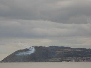
air show on the sky and around the Hill Bray Head. It was a modern
surprise to the fine weather, the nature paradise as well as to Irish
history. So many peoples - the Vikings, the Normans, the English, the
Celts (Iris ancestors) - left their mark on Irish history, geography and
culture.
 |
| Killiney Hill: Pietinis šlaitas su
vaizdais į Bray Head*southern slope with views of Bray Head |
KILLINEY: IRISCHE GEGENWART
Ein eigenes Paradies findet man
auch im Killiney Hill Park, 20 km südlich von Dublin entfernt. Ein
Obelisk (1742 errichtet) markiert seinen höchsten Hügel Killiney Hill
(irisch: Cnoc Chill Iníon Léinín) mit einer Höhe von rund 160 Metern.
Von da aus kann man bei gutem Wetter im Nord-Westen Dublin sehen, im
Osten - die Bucht von Dublin und weiter die Irische See, im Süden - die
Wicklow Mountains mit dem Hügel Bray Head und der Stadt Bray. Am
südlichen Hang vom Killiney Hill findet man riesige Steine, die
ausgezeichnet sowohl zum Sitzen, als auch zum Picknicktisch passen. Von
da aus boten sich die schönste Aussicht auf die Landschaft sowie der
beste Aussichtspunkt zur Beobachtung der Flugshow am Himmel und um den
Hügel Bray Head. Das war eine moderne Überraschung zum guten Wetter und
zum Naturparadies von den Bergen, Wäldern und der See, wo so viele
Völker - Wikinger, Normannen, Engländer sowie Kelten (Ahnen der Iren)
ihre Spuren hinterlassen haben.
 |
| Bray
Head: kalnas kaip aviašou scena* Hill as stage for air show |
 |
| Šou žiūrovai*Spectators of air show |
KILLINEY: AIRIŠKA DABARTIS
Savotišką
rojų galima rasti ir 20 km į pietus nuo Dublino. Tai - Killiney'o Hill
Park, kuriuo vadinamas mišku apaugęs kalnynas. Ant jo aukščiausios
kalvos - Killiney Hill (air.: Cnoc Chill Iníon Léinín), kurios aukštis
apie 160 m, pastatytas obeliskas (1742 m.) su užrašu "Šie metai buvo
sunkūs dėl sunkiai praeinamo Killiney..." Kaip nori, taip suprask!
Užlipti nėra sunku, o jei geras oras, tai viršuje atsiveria gurmaniškas
vaizdas: šiaurės vakaruose slėnyje snaudžia Dublinas; rytuose tyvuliuoja
Dublino įlanka, o už jos - Airijos jūra; pietryčiuose vos vos matomas
Wales'o kalnų kontūras; pietuose - Wicklow'o kalnai su kalva Bray Head
(241 m) įbedusia nosį į bangas. Prie šios kalvos šono prigludęs Bray'o
miestelis (apie 26000 gyv.). Šis vaizdas traukė labiausiai, o žvalgytis į
jį buvo galima prisėdus ant riedulių, kuriais nusėtas pietinis
Killiney'o kalvos šlaitas ir kurie puikiai tinka dar ir pikniko stalui.
Ant tų riedulių galbūt sėdėjo ir iš kontinentinės Europos čia atsikėlę
keltai (airių protėviai), ir čia atsibastę vikingai (8 a.), ir
kviestieji normanai 9-12 a., ir nekviestieji anglai, viešpatavę Airijoje
iki 20 a. Ir dabar daugybė airių buvo sutūpę ant akmenų ir vis kažkur
dairėsi pro žiūronus. Staiga pasirodė vienas, po to trys, tada penki ir
galiausiai septyni lėktuvai - jie visą dieną kūrė šou Bray kalvos fone,
skleisdami dūmų uždangas. Iššovę saliutus danguje, pavakare lėktuvai
dingo už horizonto.
Kartais Airijoje pavyksta aptikti ir tokį airišką
rojų, kai būna penki viename: jūra, kalnai, miškas, geras oras ir
netikėtai - aviacijos šou.
AIR SHOW
ĮŽANGA su 1 ir 3
lėktuvais*OPENING with 1 and 3 planes

PAGRINDINĖ DALIS su 5 ir daugiau
lėktuvų*THE MAIN PART with 5 and more planes
1-asis šou* The 1st show
2-asis šou*The 2nd show
PABAIGA*END


